
Help & guide
Find fire water. In seconds.
OpenFireMap shows fire hydrants, water supply points, fire stations and defibrillators from OpenStreetMap. Learn how the map works, how to print plans and how to add missing hydrants yourself.
- No account needed
- Worldwide, extra fast in 45 European countries
- Free and open
Get started
Three steps to the nearest hydrant
-
Step 1
Find a place
Type a place or address into the search field and press Enter. Or use the location button to find yourself.
-
Step 2
Zoom in
Fire stations show up early. Hydrants and defibrillators appear from zoom level 15, with symbols from 17.
-
Step 3
Check a symbol
From zoom level 18, a symbol shows type, diameter, number and more as soon as you point at it with the mouse. Clicking or tapping a hydrant draws a 100 metre radius.
What you see at each zoom level
The current zoom level is shown in the status box.
- Zoom level 11OverviewNo objects yet
- Zoom level 12Fire stationsas dots
- Zoom level 14Station symbolsand municipal borders
- Zoom level 15Hydrants & AEDsas coloured dots
- Zoom level 16Radius100 m when tapped
- Zoom level 17Symbolstype at a glance
- Zoom level 18Detailson hover
The interface
Every button explained
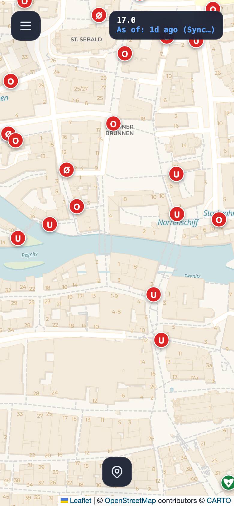
Choose your device and click an entry. On a computer the tools sit at the top left; on a smartphone they are in the menu.
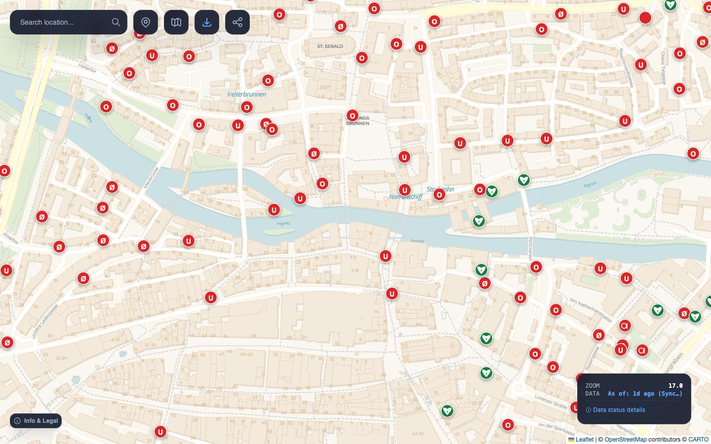
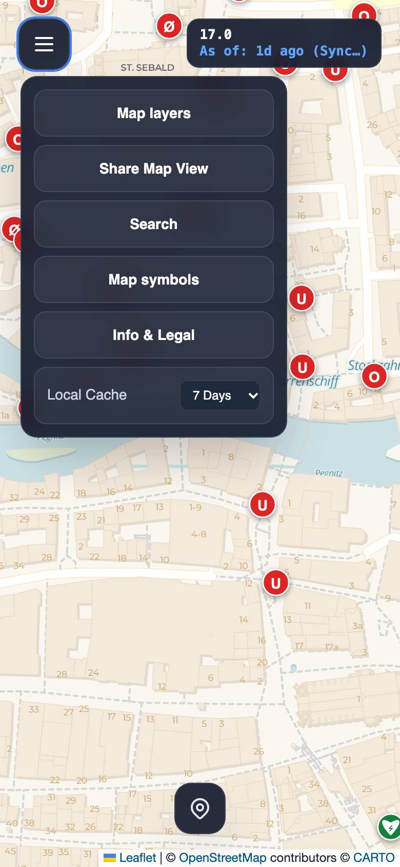
Export and the town plan are only available on a computer. On a smartphone you can start OpenFireMap like an app via “Add to Home Screen”.
All topics
What do you need help with?
Map on a computer
Search, layers, sharing, keyboard
Map on a smartphone
Menu, location, start like an app
Layers & map symbols
Backgrounds, zoom levels and every symbol
Town plan New
Print-ready plan with legend and index
Overlay
Fire service layers in your own map
Contribute
Add hydrants to OpenStreetMap
Export
PNG, PDF, GPX and CSV, up to 10 × 10 km
Data & freshness
Where the data comes from and how current it is
Accessibility
Keyboard, screen readers, reduced motion
Town plan
From map view to printed plan
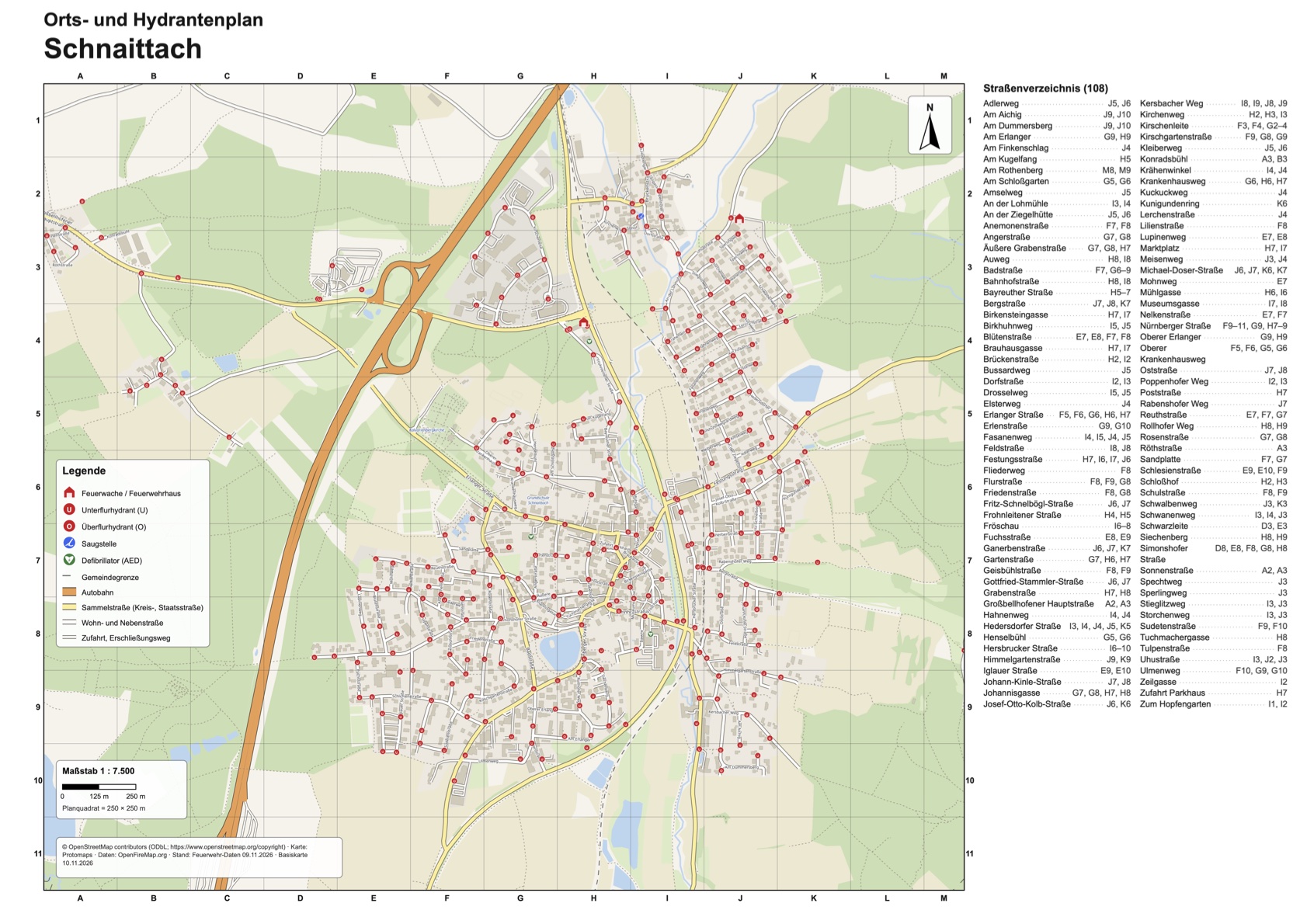
The town plan turns OpenFireMap into a print-ready sheet with grid, legend, north arrow, scale bar and street index. For the fire station wall, training or the folder in the vehicle.
- Area & format
Drag a frame on the map, choose paper size and scale.
- Content
Decide which objects, which legend and which index go on the sheet.
- Arrange
Place title, legend and index, then save as PDF or PNG.
- On a computer
- Base map for Germany
- PDF and PNG
Contribute
A hydrant is missing? Add it.
All data comes from OpenStreetMap. What you add there shows up in OpenFireMap once the services it relies on have processed the change. Pick the tool that suits you.
-
On site · phone
Hydrantenjäger
Stand in front of the hydrant, take a photo, choose the type, upload. In under 20 seconds.
Guide -
On the go · app
StreetComplete & Every Door
Answer questions about objects nearby. Good for adding details on a walk.
StreetComplete Every Door -
On a computer · browser
iD editor
Right on openstreetmap.org. Place a point, choose the “Fire Hydrant” preset, save.
Edit -
For experienced mappers
JOSM & Vespucci
For many hydrants at once or careful work across a whole town.
JOSM Vespucci
emergency=fire_hydrant
fire_hydrant:type=underground
fire_hydrant:position=sidewalk
fire_hydrant:diameter=80
- Only add what you have seen on site yourself.
- Do not copy data from water utility plans without their permission.
- When saving, add a short note on what you changed.
- Step-by-step guide
Good to know
What OpenFireMap is and what it is not
In an emergency, always call first
OpenFireMap is not an operational resource. The data may be incomplete or out of date and does not replace information from dispatch centres or water utilities. In Europe the emergency number is 112.
Data from OpenStreetMap
Volunteers add hydrants, stations and defibrillators. The more people contribute, the more complete the map becomes.
Regularly refreshed
For Germany, Austria, Switzerland, Liechtenstein and Luxembourg, OpenFireMap usually rebuilds the prepared data daily, for 40 more countries weekly. The map also requests new entries live.
No account, no ads
A non-commercial project. The map runs in your browser.
Works with a keyboard
All menus, symbols and the export can be used without a mouse.
FAQ
Frequently asked questions
Why don't I see any hydrants?
Hydrants appear from zoom level 15. Zoom in further. If you still see none, nobody has added any in this area yet. You can change that.
When will my new hydrant appear?
This cannot be predicted exactly. OpenFireMap requests new and changed objects through the Overpass API. They appear once the Overpass server has processed the change; caches can delay this a little. If Overpass is overloaded or unreachable, the change appears later. Deleted objects only disappear with the next data update. More under Data & freshness.
Why is there no export on a smartphone?
Print-ready plans need a lot of memory and a large screen for selecting the area. Export and the town plan are therefore only available on a computer.
May I print plans for my fire brigade?
Yes. The data is licensed under the Open Database License. Every plan must show “© OpenStreetMap contributors”. The town plan prints this credit automatically.
Does the map work offline?
Only partly. Areas you have loaded stay in memory for a while. New areas and search need a connection. A printed town plan is more reliable on the road.
Is this an official fire service map?
No. OpenFireMap is a private, non-commercial project based on OpenStreetMap. It does not officially work with any authority or fire service.
How do I get the fire service layers into my own map?
With the overlay. The overlay page has a demo and a PDF guide. To get your domain enabled, drop us a line.