
Town plan
Create a town plan
The town plan turns OpenFireMap into a print-ready sheet from A4 to A1, with grid squares, legend, north arrow, scale bar and street index.
What the town plan is for
A printed plan works without network, without battery and with gloves on. Typical uses:
- Wall plan at the fire station with all hydrants in your response area
- Vehicle folder with plans of individual districts
- Training and briefing new members
- Pre-planning for sites with high fire water demand
Unlike the export, the town plan has a fixed scale, a grid with squares (A1, B2 …) and a street index that lists the squares for every street.
What you need
- A computer with a current browser. The town plan is blocked on smartphones because the frame and preview need a large screen.
- An area in Germany. The base map of the town plan currently covers Germany. Outside it, the assistant reports that the frame is not within the data area.
Start the town plan at openfiremap.org/ortsplan. The assistant has no place search yet: pan and zoom the map to your town, then draw the frame.
Step 1: Area and format
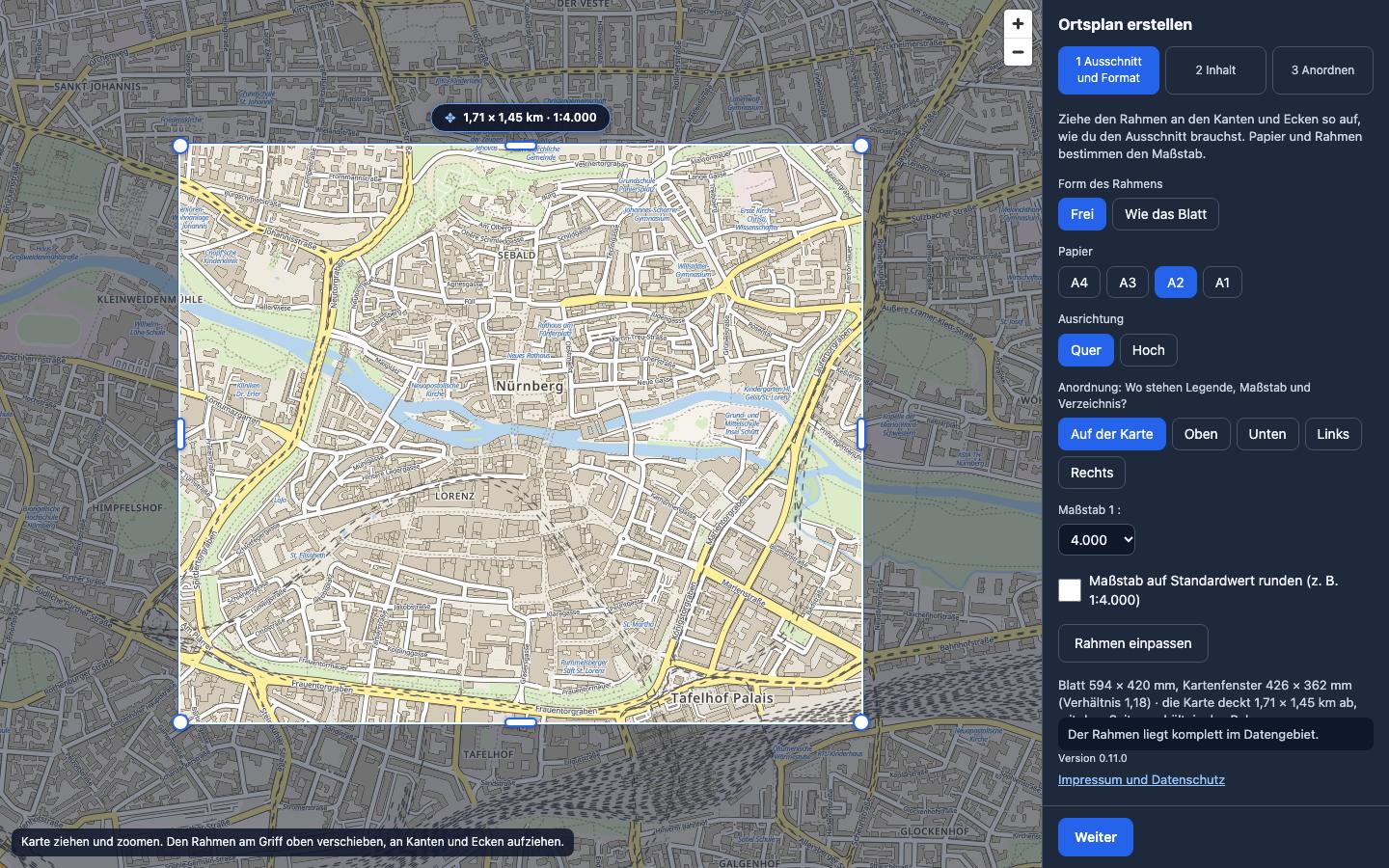
The light frame on the map shows what goes on the sheet.
- Moving the frame: drag the handle at the top centre. Drag the edges and corners to resize it. Pan and zoom the map underneath as usual.
- Form des Rahmens (frame shape): Frei (free) allows any shape, Wie das Blatt (like the sheet) keeps the paper's proportions.
- Papier (paper): A4, A3, A2 or A1, plus Quer (landscape) or Hoch (portrait).
- Anordnung (layout): where legend, scale and index go: Auf der Karte (on the map) or above, below, left or right of the map.
- Maßstab (scale): follows from frame and paper and can be fixed in the list. Maßstab auf Standardwert runden rounds, for example, 1:3,870 to 1:4,000.
- Rahmen einpassen (fit frame) sets the frame to match the chosen paper.
Below the settings you see the sheet size, map window and the area covered in kilometres. The line below reports whether the frame lies entirely within the data area.
Step 2: Content
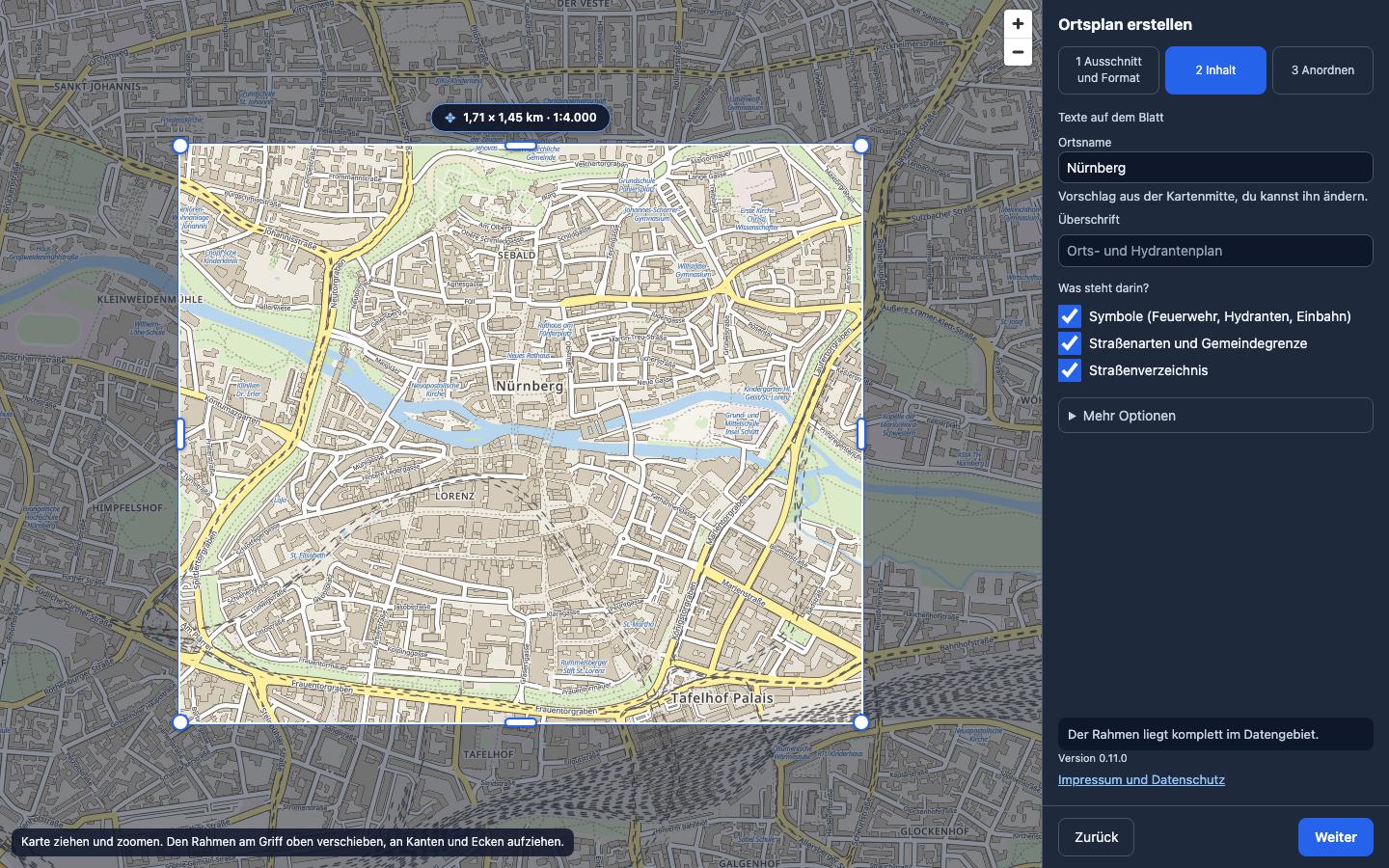
- Ortsname (place name): printed large in the title. The assistant suggests the name of the place at the centre of the frame.
- Überschrift (heading): printed above the place name, for example “Orts- und Hydrantenplan” (town and hydrant plan).
- Was steht darin? (contents): symbols (fire service and hydrants), road types and municipal border, street index. Each can be switched off.
- Mehr Optionen (more options): resolution (96 to 300 dpi), number of columns and font size of the index.
Step 3: Arrange
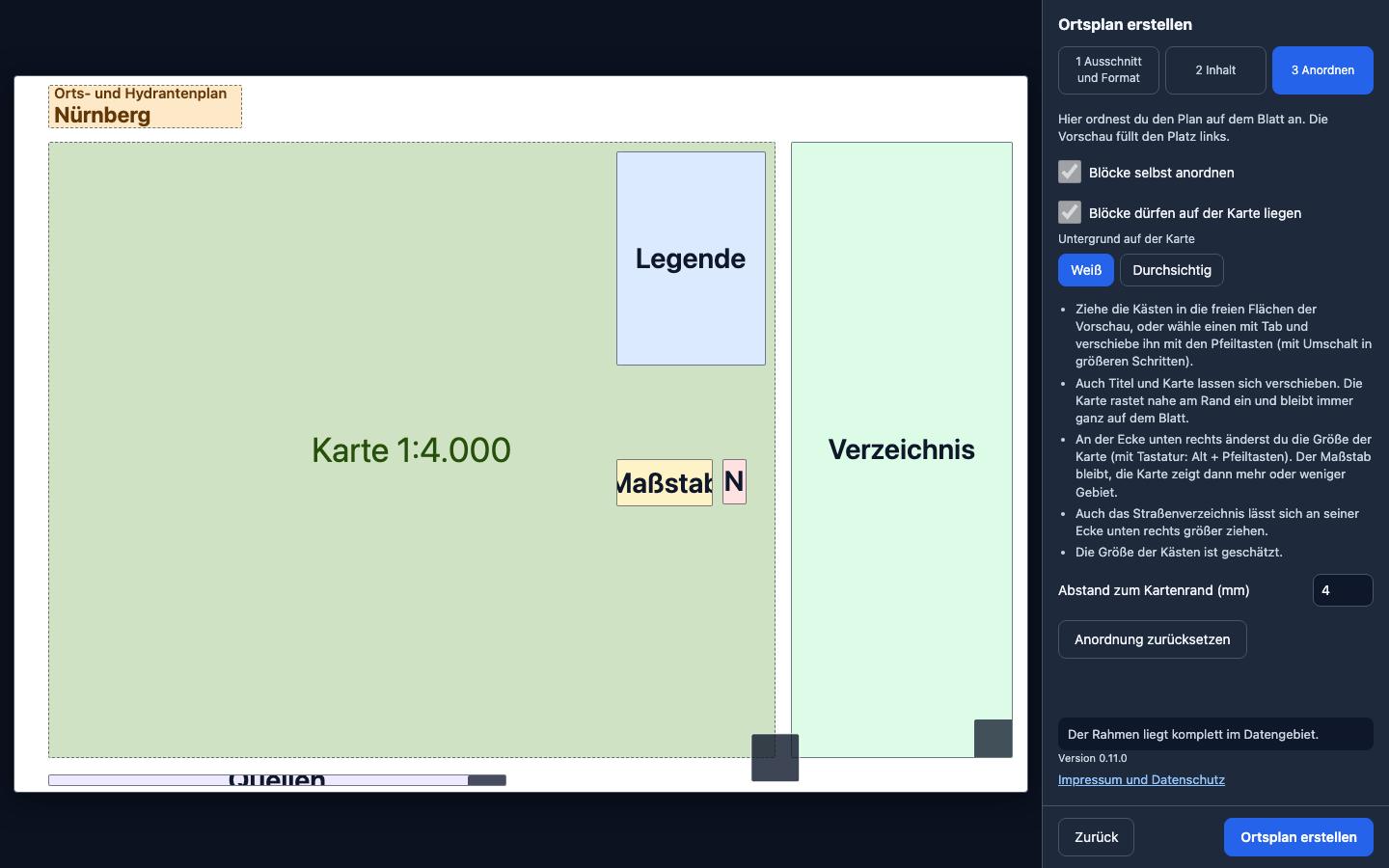
The preview shows where everything sits on the sheet. By default the assistant arranges everything itself. With Blöcke selbst anordnen (arrange blocks yourself) you take over:
- Move: drag boxes into free areas, or select one with Tab and move it with the arrow keys (with Shift in larger steps).
- Title and map can be moved too. The map snaps near the edge and always stays fully on the sheet.
- Map size: drag the bottom right corner of the map (keyboard: Alt + arrow keys). The scale stays the same; the map then shows more or less area.
- Blöcke dürfen auf der Karte liegen (blocks may sit on the map): legend and scale may cover free map areas, with a white or transparent background.
- Anordnung zurücksetzen (reset layout) restores the assistant's suggestion.
Finally, click Ortsplan erstellen (create town plan).
The finished sheet
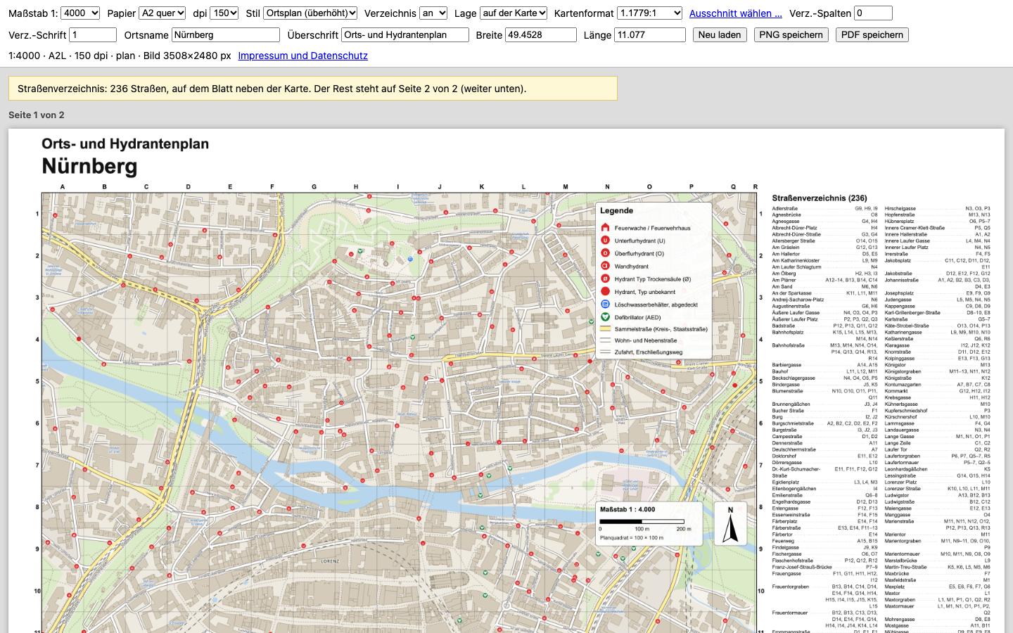
The sheet opens at full size. In the bar at the top you can still change scale, paper, resolution and texts and apply them with Neu laden (reload). If the street index does not fit on the sheet, it continues on a second page; a note above the sheet tells you.
- PDF speichern (save PDF): the sheet at paper size, ready to print.
- PNG speichern (save PNG): the sheet as an image, for example for a presentation.
Printing correctly
- Open the PDF and choose Print.
- Set scaling to Actual size or 100%, not “Fit to page”. Only then is the scale correct.
- Choose the paper size you set in the assistant (A2 and A1 usually at a print shop).
- After printing, check the scale bar with a ruler.
Good to know
- The data is as current as OpenStreetMap; the date is printed on the sheet. Print new plans after larger changes in your town.
- The town plan prints the credit “© OpenStreetMap contributors” automatically. It must stay on the plan.
- If a hydrant is missing from the plan, it is missing from OpenStreetMap. Add it and it will be on your next plan.
Your question is not here? Write to us: info@openfiremap.org
All topics